


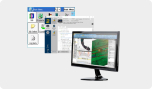


FARO As-Built Software Suite
Subscription-based on-demand as-built data for building design
Redesign of a building for repurpose, enhancement or maintenance requires on-demand, accurate and complete information of the as-built site to ensure your ideas will work. Failure in design results in cost overruns, unnecessary rework and diminished quality. The FARO As-Built Software Suite ensures architects and engineers efficiently create building designs based on precise as-built data that’s fully compatible with their CAD and BIM systems.
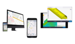
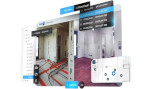
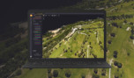
Whether modeling infrastructure design, 2D building designs, industrial and MEP facilities, excavation or calculating orthophotos from point cloud data, As-Built AutoCAD® gets the job done. Equipped with a full set of easy-to-use functions, it extends the local AutoCAD® cloud functionality with versatile and useful tools for point cloud processing. As-Built for AutoCAD® enables flexible and efficient modeling and documentation of building and inventory elements, piping systems and steel structures, earthworks and civil engineering projects such as tunnels, bridges or highways.
Next to the point cloud functionality, the software offers photogrammetric functionality. High definition photos (originally from digital cameras) support the processing of laser scanner data and enable the rapid construction of 3D wireframe models and surfaces.
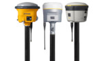
A compatible interface for all stations enables the range of functions and creates the drop points from design to reality.
As-built For Revit: Building Performance In Bim Extraction Of Scan Components
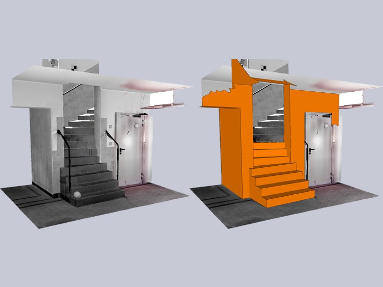
FARO As-Built for Revit® is designed for architects, engineers and general contractors who need to quickly and accurately analyze 3D laser scan data directly in Autodesk® Revit®. With customized functions for BIM model creation, alignment, editing and analysis, users are able to comply with the complete workflow around the building life cycle. Effective models of ground surfaces, walls, doors and windows, columns, beams and pillars, roofs or even pipes.
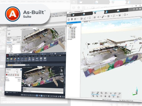
As-Built Suite: Complete Solution For Reality Data Evaluation
The As-Built Suite is a product bundle of FARO’s As-Built for AutoCAD® and As-Built for Revit® plug-ins. It provides a complete set of powerful general purpose and industrial point cloud processing tools under one license. AEC professionals such as service providers can use the As-Built Suite for intelligent feature extraction, CAD design and scanning to BIM.
Since all software tools are stored under one license, the As-Built Suite offers convenient and accessible software usage.
FARO As-Built Modeler: The Most Direct Path From Reality to Any Design System
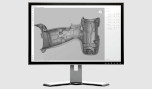
- As-Built Modeler enables architecture, engineering and construction (AEC) professionals to extract building information, such as CAD and BIM geometry, from 3D data for use in any CAD system, even if it does not support point cloud data. Users can display, manage and evaluate point cloud projects of unlimited size, independently from their source. Overall design productivity is greatly accelerated by using user-friendly tooling to apply measurements, extract highly accurate CAD models and create photorealistic renderings.
FARO As-Built for AutoCAD® Software
- As-Built for AutoCAD extends the capabilities of As-Built Modeler with functionality for evaluating 3D laser scanner data directly in AutoCAD. The software extends AutoCAD tooling for point cloud management, modeling and design validation with data captured from a variety of mapping systems and laser scanners. Results of the evaluation are native AutoCAD files and object structures without any limitations in compatibility.
FARO As-Built for Autodesk® Revit®
- As-Built for Revit extends the capabilities of Modeler with quick and intuitive workflows for processing 3D as-built laser scanning data directly in Revit using Revit objects and BIM models. It is the perfect complement for Revit users working with large point clouds and integrates seamlessly with the familiar Revit user interface. It features a wide range of evaluation tools for 3D laser scan data with customized commands for modeling and detailing BIM elements.
FARO As-Built for AutoCAD® Functional Key includes:
Easily manage large 3D scanning projects
- As-Built for AutoCAD® integrates seamlessly into the familiar AutoCAD® user interface, which works with Autodesk’s physical point cloud engine (RCP / RCS). With an efficient data management system and an extensive view option, scan navigation is simplified and provides an overview and full control of the project with a much clearer view of cloud data on a physical point compared to native AutoCAD®.
Quick and easy export of 2D drawings and 3D models
- As-Built offers powerful tools for rapidly building 2D designs. Best-fit line extraction, combined with optional corner constraints, can be automatically placed on point crush slices. Design and dimensioning commands for structural elements ensure quick and easy analysis.
Intelligent piping and steel material models for use in installation and BIM software
- As-Built provides intuitive workflows for modeling piping systems and steel structures. The results of the automated yet user-controlled workflows are highly accurate models of piping and stacked steel that meet the design constraints of the facility design software. Flange attachment points can be precisely determined without modeling.
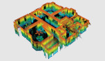
Analysis tools for tolerance checking, collision detection and volume calculation
- Deviations of CAD models built with a point cloud are displayed in contoured heat maps, elevation drawings, or lists and are used to verify modeling accuracy. Other analysis tools include e. G. tank analysis, mass and volume calculation.
Use images and photogrammetry features in AutoCAD®
- Photogrammetric functions complement the evaluation of data collected by laser scanners, drones or cameras and complement the evaluation with accurate and simple data extraction from images. Detailed, true-to-scale drawings allow easy drawing of CAD parts and facade plans.
Combine feature data with CAD objects and structured room schedules
- Space polygons and additional spatial information are managed in a clear and freely customizable tree structure. Area data can be exported to text tables or directly to databases (for example a CAFM system). The tool can be used to document damage and finds for heritage projects and building monitoring.
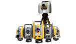
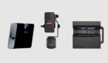
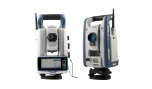
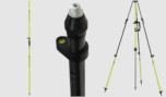
Connect a full station to AutoCAD® space
- Users draw complete mirrors, sections and elevations directly on site or create a 3D and closed loop, which is later used as a framework for placing laser scans. With automated total stations users can separate reports from design to reality.
Keep the overview, guaranteed
- The Section Manager allows users to cultivate point clouds within Revit® regardless of using the current view and provides a more precise orientation in part to the hierarchically organized sections of the point cloud. FARO SCENE users can use Planar, Quick and 3D views to work directly with FARO As-Built tools in Revit®. This facilitates orientation, increases processing accuracy, and allows users to easily manage and navigate scanner data.
Create 3D models directly in Clouds Point Revit®
- FARO As-Built for Revit® plug-in features a wide range of 3D construction aids. Within the application, users can create 3D model lines and construction points using true 3D point-to-point cloud, regardless of Revit® work layers. Users can intersect model airplanes to create accurate intersection lines and intersection points, as well as create established working planes directly on point clouds.
Save time and money with automated functionality
- With FARO As-Built for Revit® walls, pipes and structural elements such as beams and columns can be created very quickly and accurately. Wall types for different wall thicknesses are defined automatically. The wall alignment tool allows users to align, fix, and correct spanning walls throughout the model. Additional functions include the automatic creation of deformed floor slabs based on floor irregularities as well as the creation of a ground surface (topo surface). Functions to model the pipe from the scan data enhance Revit’s capabilities to collect the generated elements.
Compare the model with reality
- Surface analysis allows comparison between the point cloud and the Revit® model. Results can be exported as profile lines or to databases. Complex land surface models can be created from profile lines along with complex model components.
Work with laser scanner data directly in the family processor
- FARO As-Built allows the use of 3D scanner 3D data directly in the Revit® family editor. Creating custom object families for doors, windows, columns, or piping accessories is simple and easy using point cloud regions, scan planar views, and correct orthophotos.
Features at a glance
BIM Extraction
Use automatic tools to extract objects and object systems for several disciplines of architecture and craft trades, plant engineering, MEP engineering, structural engineering and civil engineering. Powerful tools allow you to apply constraints to the design (e.g., keep highest accuracy while forcing the extracted model to be watertight).
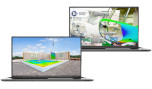
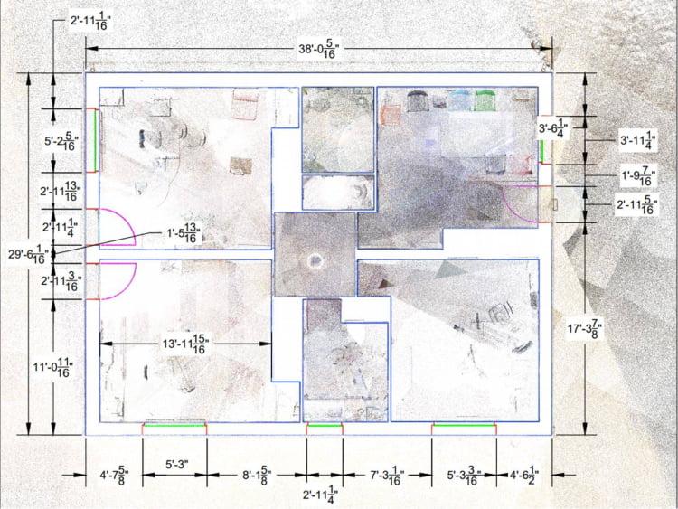
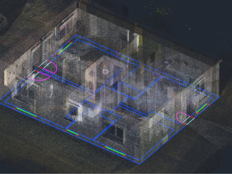
Floor Plans, Elevation Plans and Facade Plans
Creating slices and cross sections in the point cloud provides an overview of the as-built situation. Automatic tools help you extract line models and accelerate the creation of floor or elevation plans. Orthographic images of facades, which can be used in the CAD system, help to precisely plan assembly structures or preservation tasks.
CAD Extraction
Extraction of surfaces and exporting in common CAD exchange formats (DXF, STEP, IGES) allow you to turn the point cloud into a CAD model, which can be used in your well-known CAD systems as an accurate as-built representation of the site.
Design Validation
Virtually overlay your design with the as-built site in order to check if it will fulfill the clearance requirements or if it must be adjusted to avoid clashes. Tools for automatic surface deviation analysis or clash/clearance detection keeps the time investment to a minimum.
Precise Measurement
Take measurements with millimeter-level accuracy. Measure distances, areas, volumes, clearances or highly precise tie-in points to bring your designs to next-level quality.
Applications

Earthwork
Generate fast, accurate volume calculations of scanned stockpiles or excavations within building or civil engineering projects. Create accurate terrain models and topographical maps for civil engineering projects. Calculate clearance measurements for tunnels, bridges or highways.
Outer Shell
Scan complete buildings to create missing as-built documentation, such as floor plans, elevation plans or façade plans, in order to plan your architectural model or assemblies such as façade panels, isolations or solar systems. Efficiently create 3D as-built models, including ground surfaces, walls, doors and windows, columns, beams and pillars, roofs or even pipe runs in commercial and industrial buildings, to kick off the BIM process with much lower effort and more confidence and transparency. Reconstruct, restore and conserve buildings and historic sites, thanks to detailed 3D scan data.
Building Systems
Rely on this unmatched solution for as-built documentation of plant and MEP systems (e.g., piping or HVAC). Use inventory documentation of system elements to create bill of materials. Get high-accuracy measurements of tie-in points and clearances for SKID assemblies or other modular exchanges.
Interior Finishing
Get true-to-deformation measurements of complex situations, such as roof structures, elevator shafts or interiors of historic buildings. Bypass outdated documentation for repurpose of buildings to plan drywall, carpentry or stairs. Validate designs to prefabricate construction modules that fit perfectly into the existing conditions without the need for rework.