DJI Terra

Make the World Your Digital Asset

DJI Terra is 3D model reconstruction software that has photogrammetry as its core technology. It supports a range of accurate and efficient 2D and 3D reconstruction of visible light, and data processing through DJI LiDAR. DJI Terra is a perfect match for DJI Enterprise drones and payloads. It works in conjunction to build a complete application solution that caters to verticals such as land surveying and mapping, power transmission, emergency services, construction, transportation, and agriculture.

Realistic 3D models can be generated in three resolutions—high, medium and low. Water surfaces in the model are automatically optimized through AI technology, and the formats commonly used in the industry are exported for image reconstruction in diverse scenarios, such as surveying and mapping, accident sites, power grid equipment, and progress-tracking for construction projects.

The algorithm is optimized according to the different scenarios to significantly improve processing efficiency, effectively avoid image warping and deformation, and obtain detailed and accurate measurement results for all your target objects and survey areas.

With just one click, you can perform highly accurate processing of the point cloud data captured by the Zenmuse LiDAR in DJI Terra, including route calculation, accurate merging of point cloud and visible light data, optimization of point cloud accuracy, extraction of ground points, and generation of fieldwork reports.

Using multispectral data from DJI Mavic 3 Multispectral and P4 Multispectral, vegetation index maps including NDVI and NDRE can be produced to provide insight into plant growth and health, radiometric correction is supported and reflectance maps can be generated for remote sensing research. Prescription maps can be created for variable rate application using DJI’s Agras drones to improve crop yields while driving down costs.

Real-time 3D Mapping

  • When efficiency is key, quickly render and visualize a 3D model of the mapped area. Make decisions based on the preliminary model and check for completeness immediately or plan 3D flights on-site.

Real-time Mapping

  • Quickly generate a 2D orthomosaic of the selected area in real-time. Not only is this ideal for creating detailed flight paths in remote areas but it’s also useful for time-sensitive missions that require quick decision-making on site.

Detailed Inspection Mission Planning

  • Automatically generate waypoints and flight routes based on one or more points selected in a local realistic 3D model or point cloud (or a third-party point cloud). A simulated camera view that includes the selected point is displayed on screen to enable better waypoint selection and more efficient flight route planning, automating inspection workflows.

Mission Types

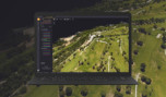
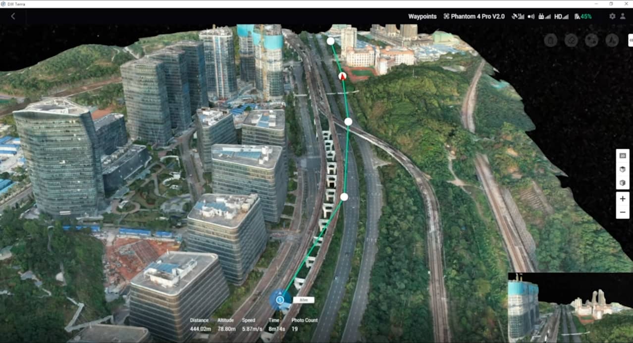
Waypoints Mission Planning

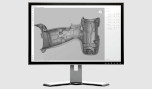
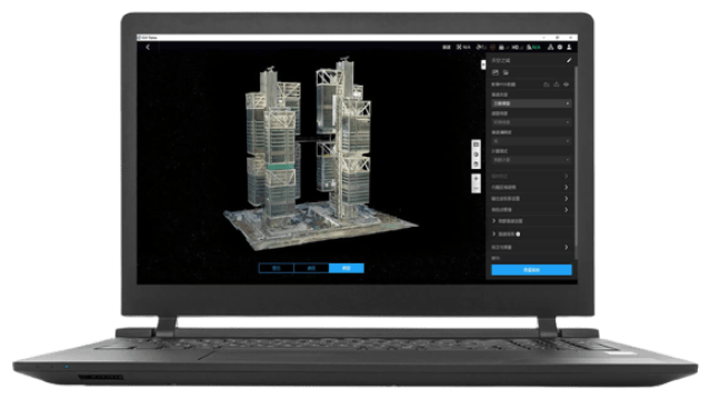
Create efficient flight paths using predefined waypoint actions and adjustable parameters like altitude, speed, gimbal pitch angle, aircraft heading and more. For more complex and tight missions that require high attention to detail, use 3D Flight Visualization to design and simulate tasks on existing 3D models.

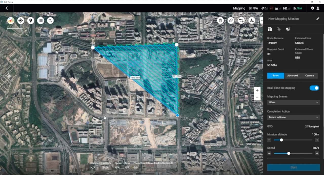
Area Mission Planning

With just a few taps on the screen, you can automate complex missions, allowing you to seamlessly capture imagery which can be processed to produce a variety of maps and models for further analysis, and to aid decision-making.

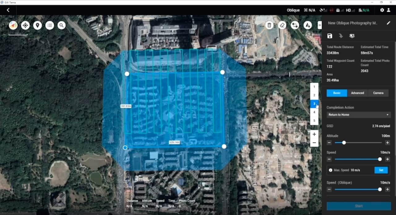
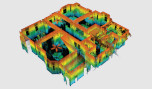
Oblique Mission Planning

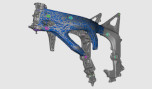
When accuracy is essential and details are vital to your critical operations, Oblique lets you capture a rich 3D model data set by adjusting the angle of the camera at a tilted angle, giving you an extra crisp view of the asset.

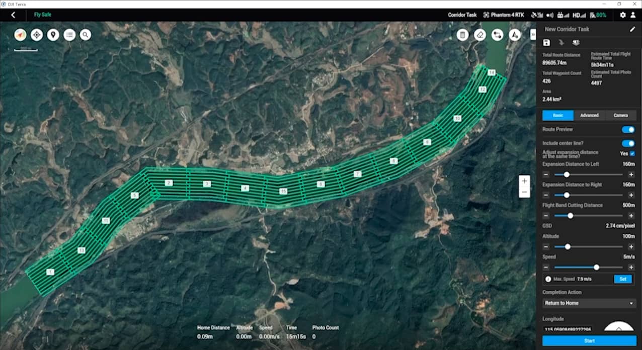
Corridor Mission Planning

Create automated flight missions around roads and railways by simply drawing a line on the map. Adjust mission settings to change the total area mapped, giving you the flexibility to choose between creating high-definition 2D maps and 3D models or quick overviews.

Media

Images

Get a Quote

Όνομα*
Επίθετο*
Email*
Τηλέφωνο*
Εταιρία*
Πόλη*
Χώρα*
Σημειώσεις